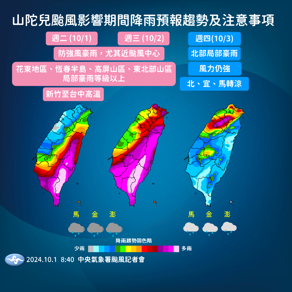
Typhoon Krathon was upgraded to a severe typhoon at 2 a.m. on Tuesday morning. As of 8 a.m., it was located 220 kilometers south-southwest of Kaohsiung and was slowly turning north to north-northeastward. The storm’s radius has remained unchanged at 220 km; however, the maximum wind speed near the center has strengthened to 198 kilometers per hour.
In light of these developments, the Central Weather Administration (CWA) has expanded the scope of the land warning to Penghu, Yunlin, Hualien, and eight counties south of these areas. They predict that as Krathon lands in southern Taiwan on Wednesday, southern and southwestern Taiwan will bear the brunt of the wind and rain.
So far, accumulated rainfall in the Pingtung, Hualien, and Taitung areas has already reached about 300 millimeters. Extremely heavy rain and high winds will persist in these regions and begin to impact northern Taiwan through Wednesday. Krathon is expected to move away from the island starting Thursday. However, northern Taiwan is likely to experience a great deal of rainfall due to the lingering effects of the storm.
Wave height in the seas surrounding Taiwan is expected to reach more than 5 meters, with the southeastern and southern seas nearest the typhoon’s center seeing waves of 6-8 meters in height. Residents in the coastal areas of Hualien and Taitung, as well as Penghu, are reminded to avoid the beach.