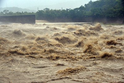
The Central Weather Bureau (CWA) says Typhoon Dujuan has made landfall in eastern and northern Taiwan.
The storm is forecast to have the biggest impact from Monday afternoon to Tuesday morning.
As of 2:00 pm, the storm was centered around 140 kilometers east south-east of Hualien in eastern Taiwan. It was moving at a speed of 19 kilometers per hour in a northwesterly direction.
Rainfall and strong winds are likely to hit most of Taiwan with mountainous regions north of Nantou County expecting heavy precipitation.
Typhoon Dujuan is forecast to make landfall in China Tuesday afternoon.
The CWA is calling on residents of eastern Yilan County and low-lying coastal areas of western Taiwan to prepare for flooding. Residents living in the off-shore islands of Kinmen, Matsu and Penghu should caution against storm surges.